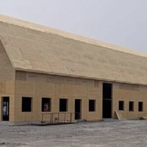

CAYUGA – Construction was stopped on the Cayuga Highway #3 bridge replacement last week by order of the Haudenosaunee Confederacy Chiefs Council through the Haudenosaunee Development Institute.
The Ministry of Transportation was notified that there has been, to date, no consultation with the HDI in regards to the construction that is taking place on the old Canal tow path.
What is known as the Tow Path is a 60-foot pathway on both sides of the Grand River between the Cayuga feeder canal to Brantford. It was originally used by the Grand River Navigation Company to tow barges along the canal. It was a land use arrangement, according to Six Nations researchers, that should have expired after the GRNC went broke in the 1840’s. As such, it is HCCC’s contention that the land was never surrendered, and therefore should not have fallen from Six Nations control.
Dufferin Construction representatives were addressed by Cayuga Chief Blake Bomberry, who ordered the work to stop until the Ministry of Transport and the Confederacy can begin the consultation process.
Thursday afternoon there was little construction being done and some of the heavy equipment was being removed from the site.
It should have come as no surprise to Dufferin or the MTO since attempts have been made by the Confederacy Chiefs Council to discuss this and other issues. However, there has been no response to their requests, leaving direct action the only remaining option.
Bomberry says that the MTO was warned that if they move ahead with this project without consultation with the HCCC, that there would be direct action to shut it down until they were willing to talk.
The preliminary work on the bridge began a year ago, which is when the HCCC first attempted to set up consultations with the MTO. There were meetings, however there was no resolution or MOU signed or agreed to as the project continued.
Tow Path Back Grounder:
In a Statute dated January 28, 1832, the Tow Path lands (sixty-six feet in width along both sides of the Grand River) from the original Welland Canal Feeder Dam in Dunnville to the Village of Brantford, was reserved for the Grand River Navigation Company. The Statute directed that payment was to be made for the use of the Tow Path lands and provided for the expansion of the works from Brantford to Galt. The Tow Path lands were not for the general use of the public, but could be open on payment of dues.
On October 26, 1843, Thomas Parke, Surveyor General, advised that a reservation of one chain in width along both banks of the Grand River for a towing path would be made in all future descriptions of lands on the Grand River.
Six Nations remain the owners of the Tow Path lands (one chain in width or sixty-six feet) on each side of the Grand River as reserved from alienation by legislation and directives of the Crown.
There has never been a surrender for the Tow Path lands allowing for the specific sale these lands. Nor has Six Nations received full and fair compensation for the Tow Path lands.